|

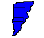
Poinsett County was formed on February 28, 1838, from parts of Greene and St.
Francis counties. The county was named for Joel Roberts Poinsett. He was a diplomat, statesman and competent amateur botanist.
The county seat is Harrisburg. The landscape of the county is rich, flat, delta farmland in the east and west and rolling
hills in the center of the county. Crowley’s Ridge splits the county. East of the ridge is cotton and soybeans and west
of the ridge is rice. Along the ridge are beef and dairy cattle. The economic base of the county is agricultural. The St.
Francis Sunken Lands Wildlife Management Area features hunting on sunken lands that were created by the New Madrid earthquakes
of 1811 and 1812, that sank the land between 15 to 20 feet in places, destroying the St. Francis River’s channel and
creating the St. Francis swamps and the Sunken Lands. After the earthquakes the federal government instituted its first “Disaster
Relief Fund” by issuing New Madrid Certificates entitling displaced landowners to new acreage in the Louisiana Purchase
Territory. Lake Poinsett, Lake Poinsett State Park, Lake Hogue, and Bayou Deview Wildlife Management area all offer fishing,
hunting and other water activities. A unique feature of Poinsett County is the sight of one river running under another. The
Riverdale Tunnel carries the Buffalo Ditch under the water of the left hand chute, a branch of the river. Many visitors enjoy
the waters and wildlife of this area. The courthouse building is constructed mainly of Bedford stone, although the large columns
on the east and west entrances, as well as the other columns and accents, are sandstone. The courtyard is enclosed by evergreen
privet shrub. The tower clock has four faces and the tower-arches and brass trim accents the red tile roof. The date of construction
in Roman numerals is inscribed over both entries: MCMXVIII.
|

